
Coordinate Systems
Horizontal Coordinate Systems
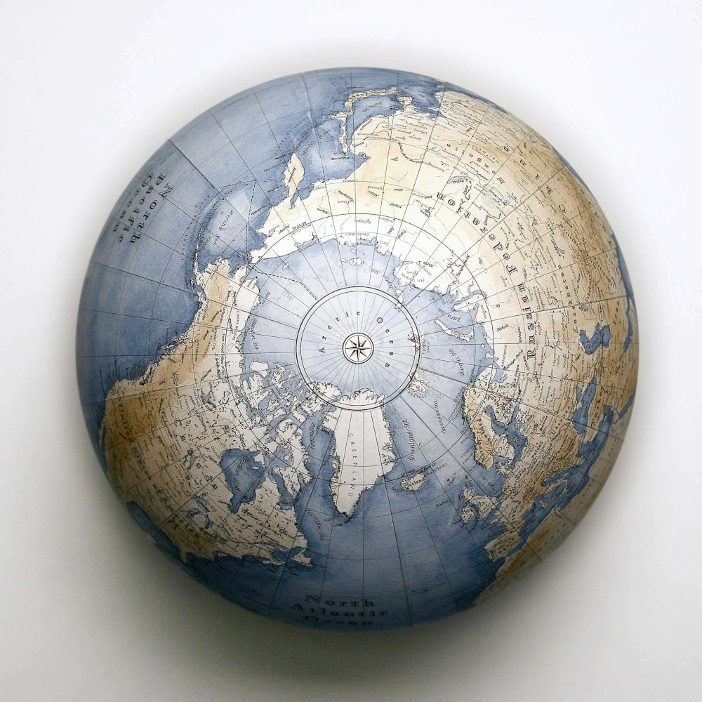
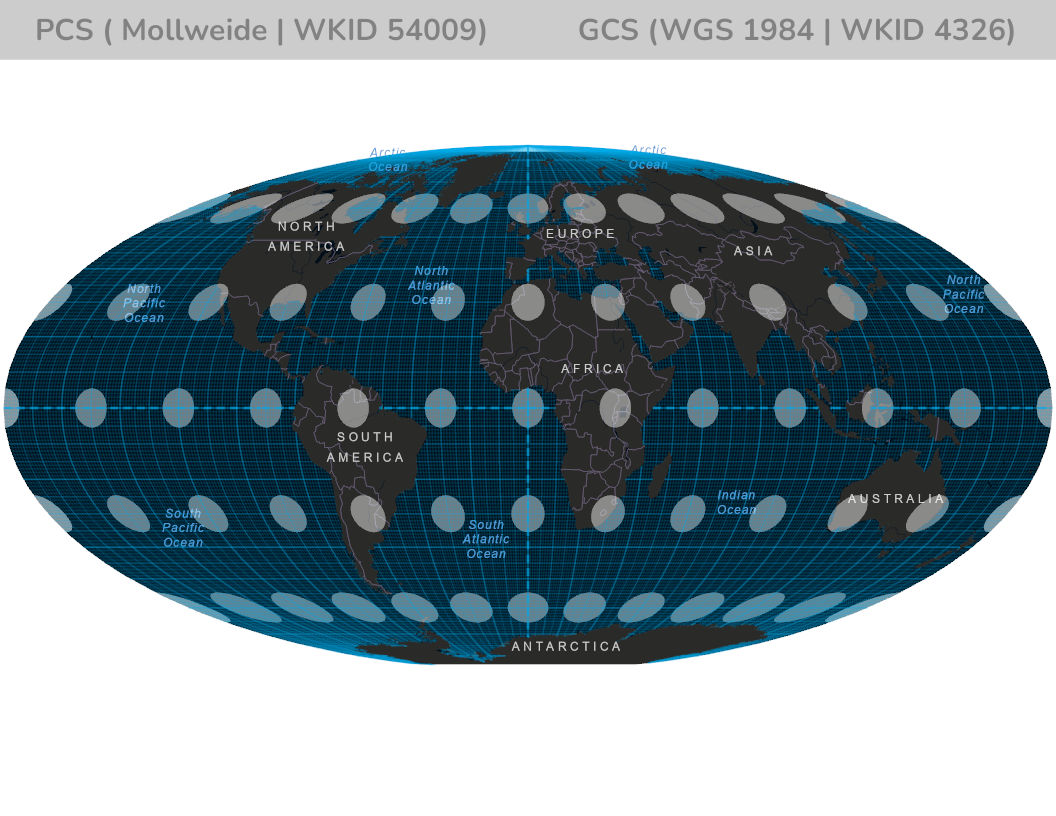
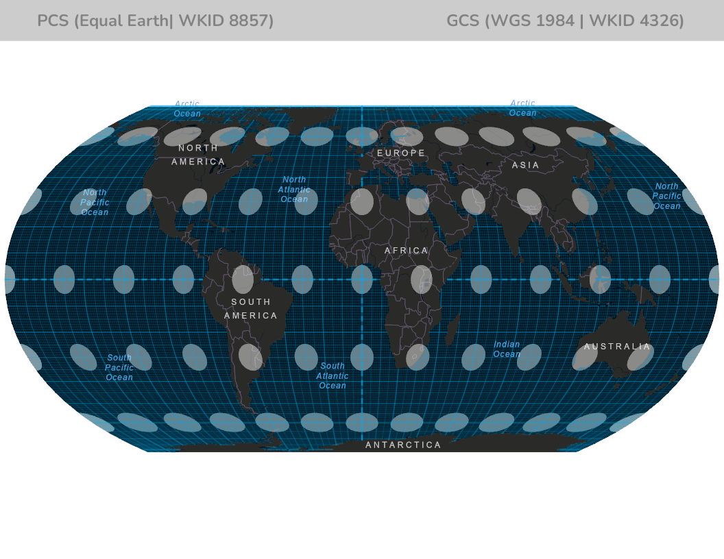
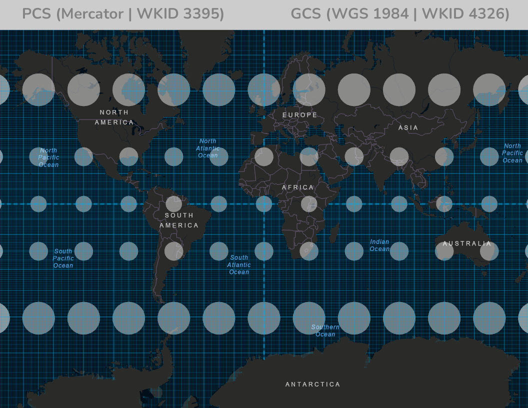
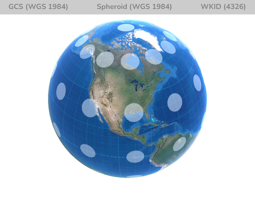
There are two kinds of horizontal coordinate systems; one is called a Geographic Coordinate System and the other is a Projected Coordinate System. The Geographic Coordinate System is based on the globe, coordinates are given in latitude and longitude. Latitude and longitude are usually given in degrees, but can be in other formats as well. Latitude is measured up and down from the equator and longitude is measured from some arbitrary zero point that is chosen called the prime meridian.
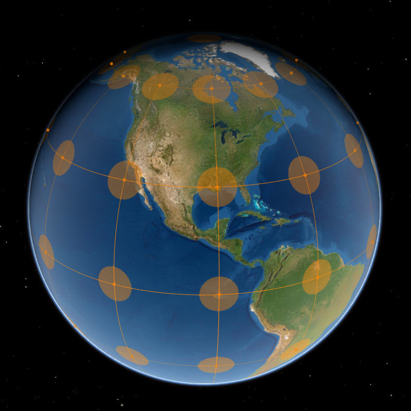
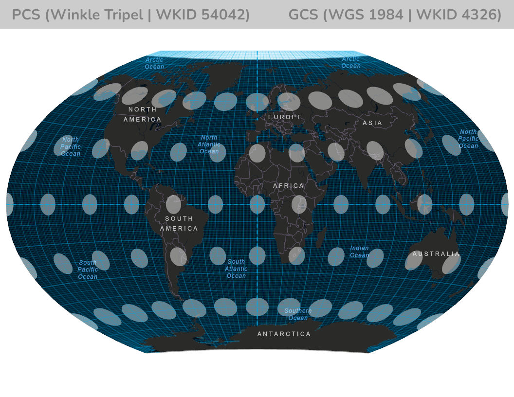
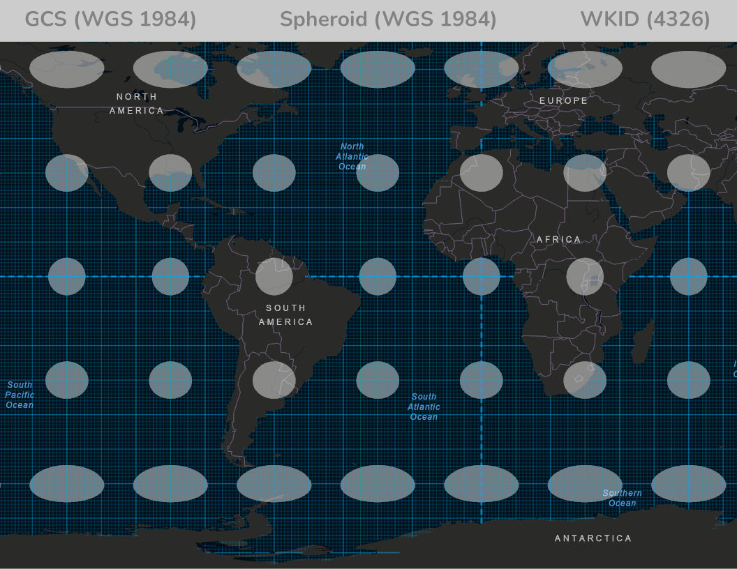
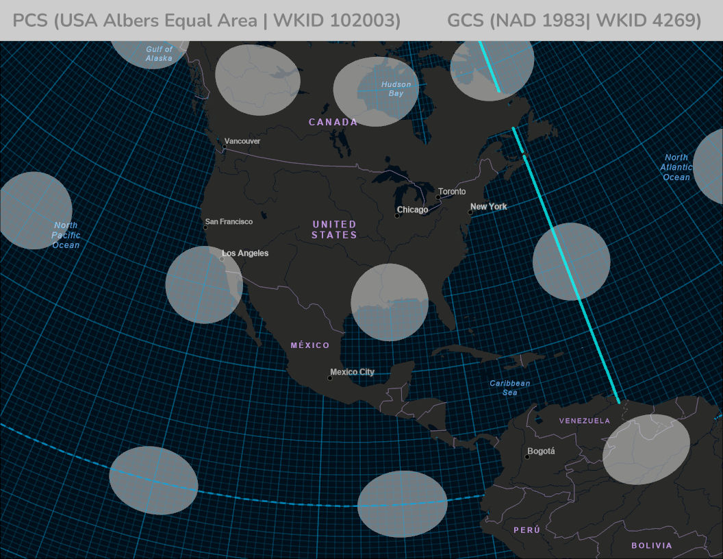
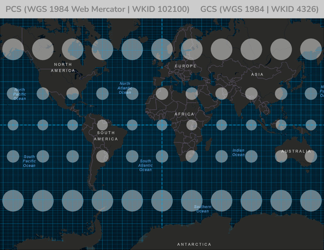
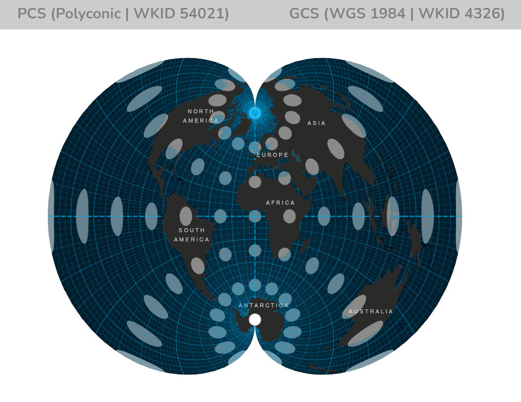
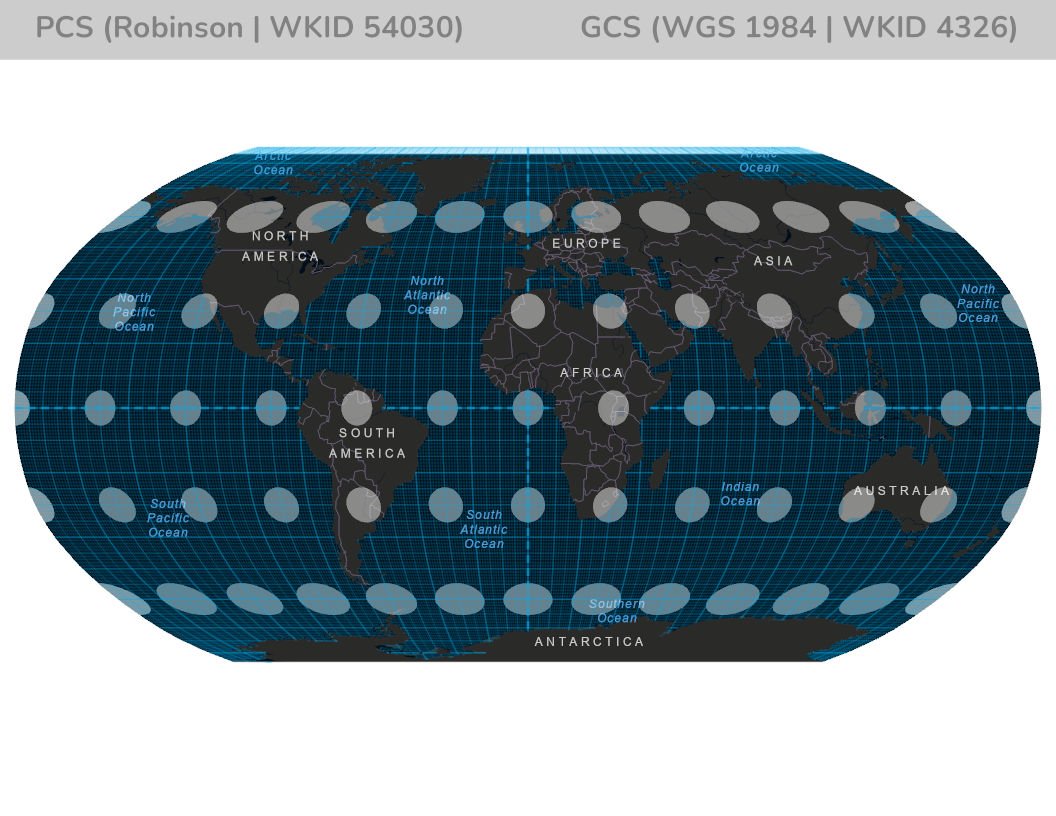
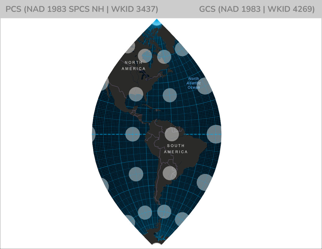
Below is an example of a Geographic Coordinate System. This particular view references a GCS which is known as WGS 84. There a two ways to specify a coordinate system in Esri’s ArcMap Software. First, is by a Well Known ID (WKID) and the second is Well Known Text. A WKID is any predefined coordinate system. If the WKID is less than 32767 it is assigned by the European Petroleum Survey Group EPSG. All WKID’s greater than 32767 are assigned by Esri. In the nineteenth century, Nicolas Auguste Tissot developed a method to compare distortion in different types of map projections (depicted below).
Projected Coordinate System’s are dealing with a flat map with xy values on a Cartesian grid (values would be feet, yards, meters). A Projected Coordinate System is always based on a particular Geographic Coordinate System. PCS contains a projection which is the mathematical algorithm used in converting between the latitude and longitude value and the XY value. There is always various parameters which are specific to the mathematical algorithm and the linear unit referenced. The State of New Hampshire uses a Projected Coordinate System which if referred to as “NAD 1983 State Plane New Hampshire FIPS 2800 Feet“.

What is happening when we do a projection? We are converting between the round globe, which has values described in degrees or some angular measurement, and we are going to a flat map with linear measurements (xy measurements).
New Hampshire uses a State Plane Coordinate System. The State Plane Coordinate System (SPCS) is a Cartesian coordinate grid laid over a map projection surface for only a small portion of the ellipsoid covering the entire State. The SPCS uses three types of projection surfaces (Transverse Mercator, Lambert Conformal Conic, and the Hotine Oblique Mercator). New Hampshire uses the “Transverse Mercator” Projection. The Transverse Mercator works well for those states that run from North to South. The PCS is known as “NAD 1983 State Plane New Hampshire FIPS 2800 Feet” (WKID is 3437 Previously 102710). The most recent up to date listing of Esri’s projections can be found here.
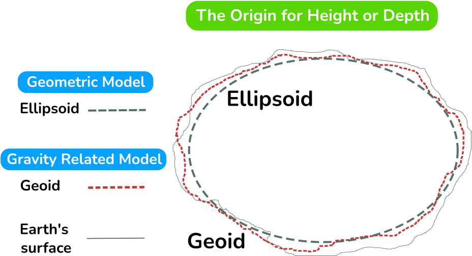
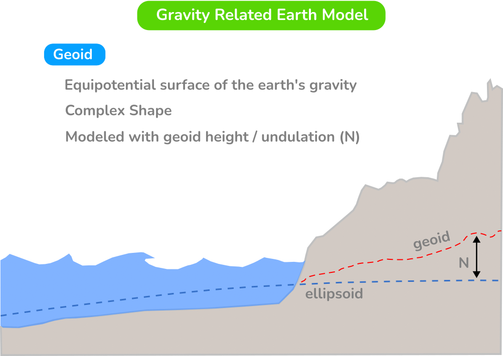
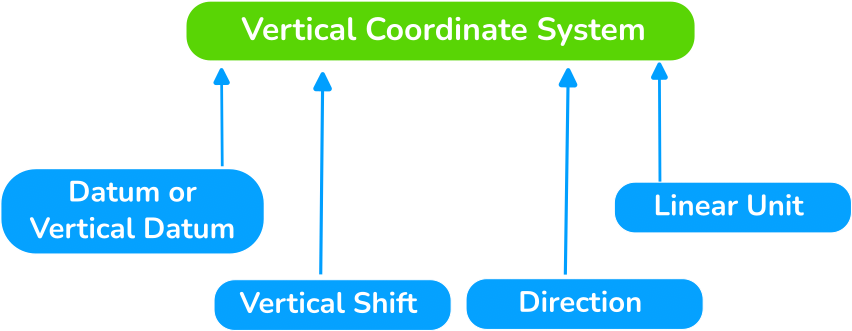
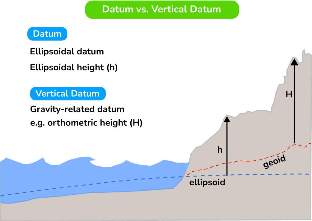
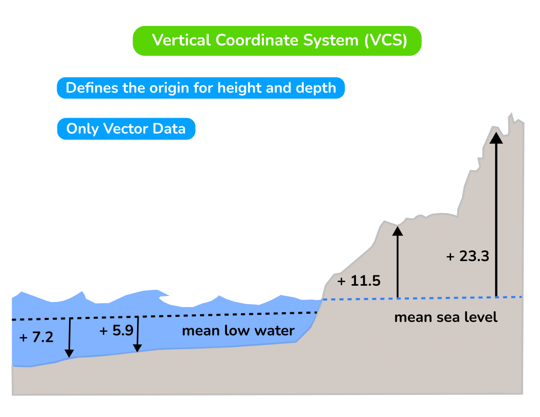
A Vertical Coordinate System has either a datum or a vertical datum. It will have a datum if it is based on measuring from the ellipsoid and it will have a vertical datum if it is based on measuring from the geoid. Then two parameters; vertical shift which is just an arbitrary value that you can specify to be added to everything and the direction. The direction is simply +1 or -1 and what you are saying is “are my values positive and are they going up which means you are typically measuring height or are they measuring down which means you are typically measuring depth”. Lastly there is a linear unit associated with it. VCS (Ellipsoidal). The listing of the most common VCS can be found here.
Transformations

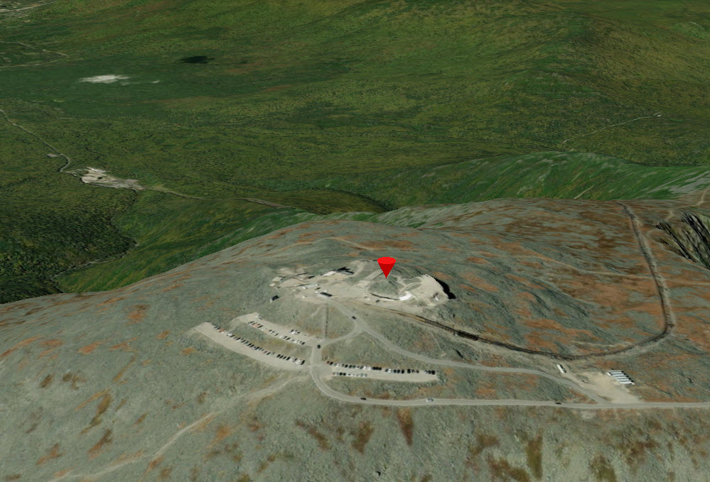
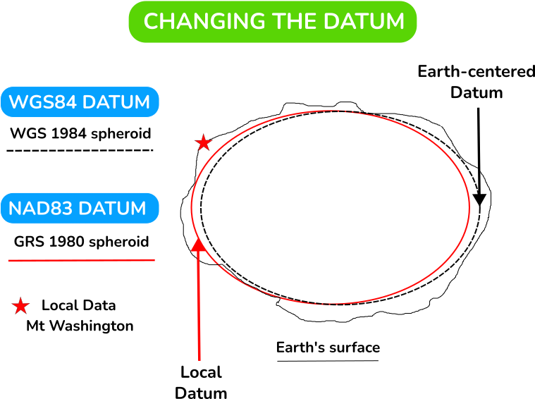
What is a transformation and why is it important? If we look at the image above, the dashed black line is our theoretical ellipsoid which does not necessarily match the surface of the earth. We have some data in the upper left; imagine you have data near Mount Washington New Hampshire which is a mile high. You are a mile high above this theoretical ellipsoid. What happens is we have an ellipsoid that really does not match the surface of the earth at that location, so what we want to do is pick a different ellipsoid which fits the surface of the earth at that location.
This particular ellipsoid works better than the other one. So in this case for instance we are looking at the theoretical WGS84 and now we have a local datum using NAD83. So the data transformation is moving the data from one of these ellipsoids to the other one. This can involve a shift, rotation, or change in direction. Think of the ellipsoid as the size and shape and the datum then fixes that ellipsoid to the earth. For simplification of the model various spheroids or ellipsoids have been created. The terms can be used interchangeably.
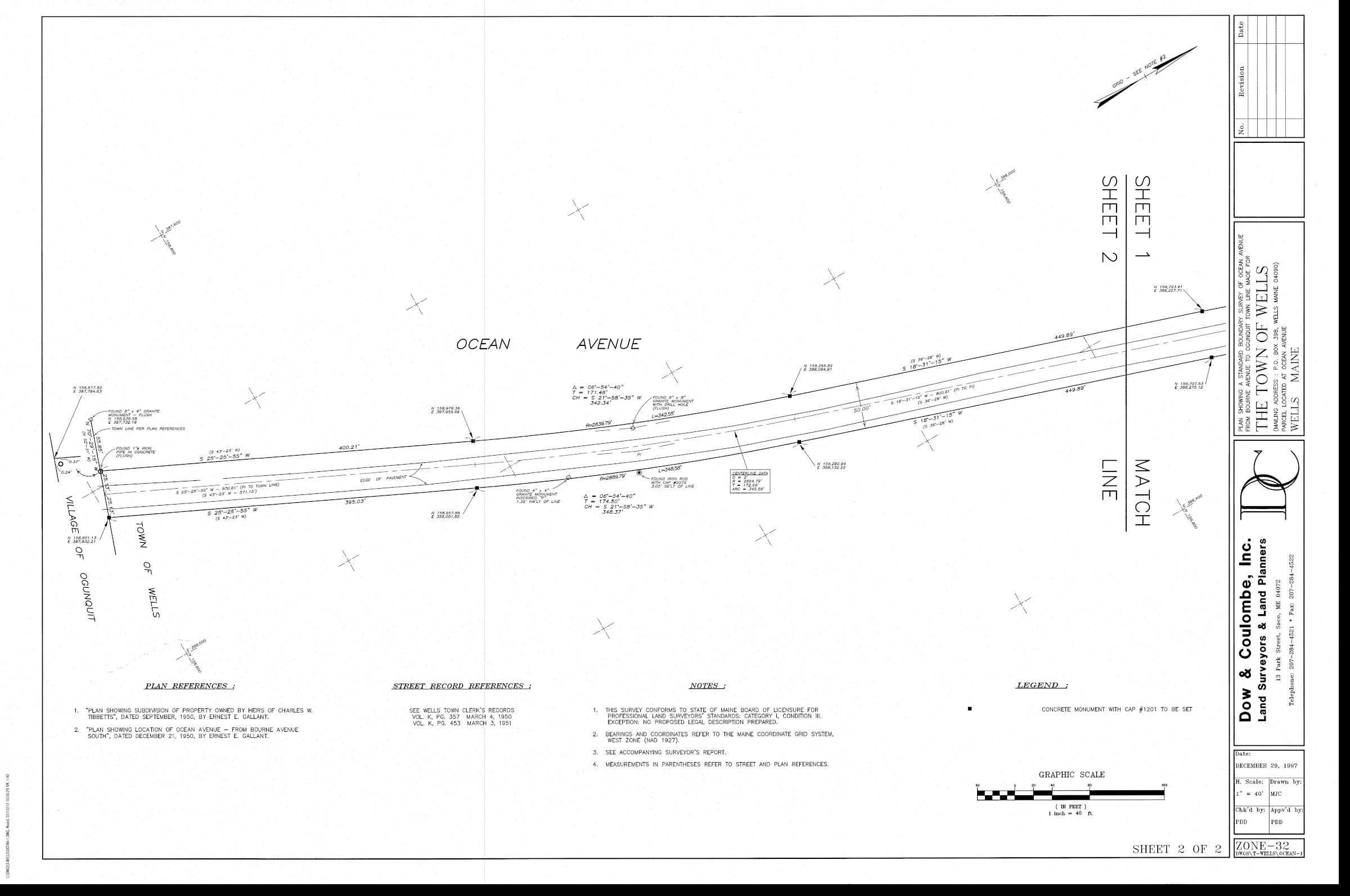
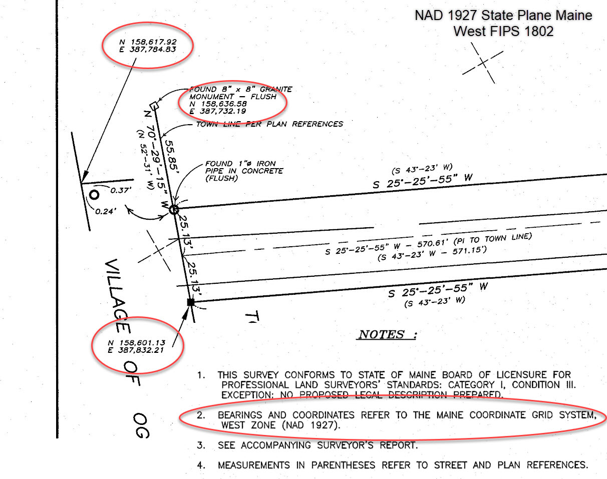
If you had ortho imagery that uses a projection of “NAD 1983 State Plane Maine West FIPS 1802” and vector data (point locations) in “NAD 1927 State Plane Maine West FIPS 1802” it would not display correctly. If you apply the transformation from “NAD 1927 to NAD 1983 NADCON”, the point data will line up correctly. A Geographic Transformation or Datum transformation typically involves moving your data not more than 100 meters. If you’re looking at a world map; you will not see a 100 meters, but the more you zoom in it will require you to transform the data. Below are a few screenshots illustrating a right of way map that has been scanned and georeferenced using the northings and eastings to provide a better level of accuracy. The point locations were geocoded using “WKID 26784” and projected to “WKID 26848“. This involved a transformation from datum “D North American 1927″ | Spheroid “Clarke 1866” to “D North American 1983″ | Spheroid “GRS 1980“.


The two kinds of transformations are geographic and vertical. The geographic (horizontal) one is shifting between the two GCS’s. You may have to do a vertical transformation at the same time, which is shifting between some ellipsoidal or geoidal view. A particular transformation goes from one GCS to another GCS.
Using the same example from above, If you wanted to scan several right of way maps that were using northings and eastings referenced in “NAD 1927 State Plane Maine West FIPS 1802″ and your current project is being referenced in NAD 1983 State Plane Maine West FIPS 1802”, it would require a transformation. Use this link to view the WebGIS application of geo-referenced survey plans that were used to geocoded northings and eastings in NAD 1927.
Geographic Datum Shift Illustration
CSV file available for download