Graticules and Grids
What are graticules? Graticules are lines showing parallels of latitude and meridians of longitude for the earth. Graticules are used to show location in geographic coordinates (degrees of latitude and longitude).
The latitude/longitude grid is based on a sphere and is familiar to most people. Lines of latitude go around the world parallel to the equator. Lines of longitude go from pole to pole. On a map, latitude lines are horizontal and longitude lines are vertical. Below is a some of the characteristics of latitude and longitude.
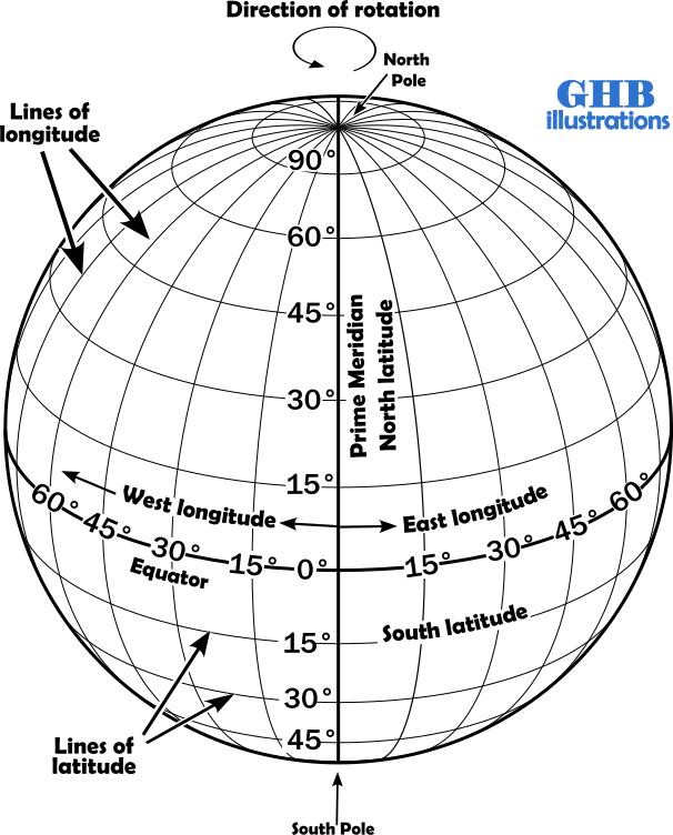
Latitude
Longitude
- Lines parallel to the equator
- Hemispheres designated North (N) and South (S).
- Equator is 0°
- North Pole is N 90°
- South Pole is S 90°
- Expressed in three formats
- Degrees, Minutes, Seconds N 44° 09’ 39.03”
- Degrees, Minutes N 44° 09.65′
- Degrees N 44.160°
- 1° of latitude is 111.12 km (69.05 mi.)
- 1’ of latitude is one nautical mile (1.85 km, 1.15 mi.)
- 1″ of latitude is 30.8 m (101 feet)
- Lines run from pole to pole
- Greenwich, England is the Prime Meridian.
- Hemispheres designated West (W) and East (E) of the Prime Meridian
- Prime Meridian is 0°
- Expressed in three formats
- Degrees, Minutes, Seconds W 71° 38’ 39.95”
- Degrees, Minutes W 71° 38.6659′
- Degrees W 71.644°
- 1° of longitude is 111.12 km (69.05 mi.) only at the equator
- 1’ of longitude is 1 nautical mile only at the equator
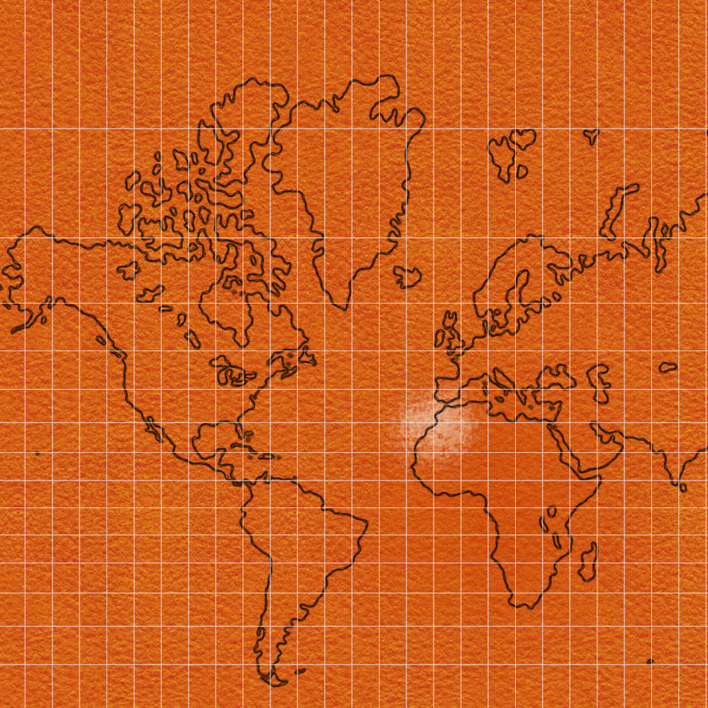
Graticules are used to show the location in geographic coordinates (degrees of latitude and longitude). Latitude and longitude coordinates are usually written with hemisphere latitude, hemisphere longitude (N44° 09.65′, W71° 38.6659′) and referred as a geographic coordinate because it is based on a sphere. Below are two online web application that will allow you to pan zoom and identify individual graticules (parallels of latitude or meridians of longitude). The graticules in the lower left example are in a projected coordinate system known as WGS 1984 Web Mercator Auxiliary Sphere. The graticules in the lower right are displayed in a geographic coordinate system known as WGS 1984.

WGS 1984 UTM Zone 19N (Meters)
The UTM Grid system divides the earth’s surface between 84°N and 80°S into 60 zones. Each zone covers 6° of longitude and is numbered sequentially with zone 1 beginning at 180°W. The zones are further divided into the northern and southern hemisphere. The designation of a UTM zone carries a number and a letter. As an example, UTM zone 19N refers to the zone between 72°W and 66°W in the northern hemisphere.
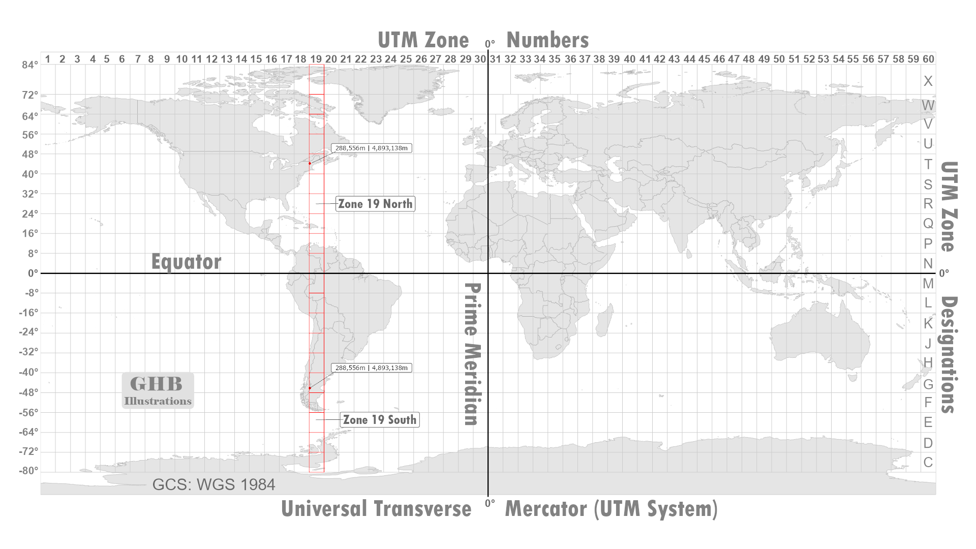
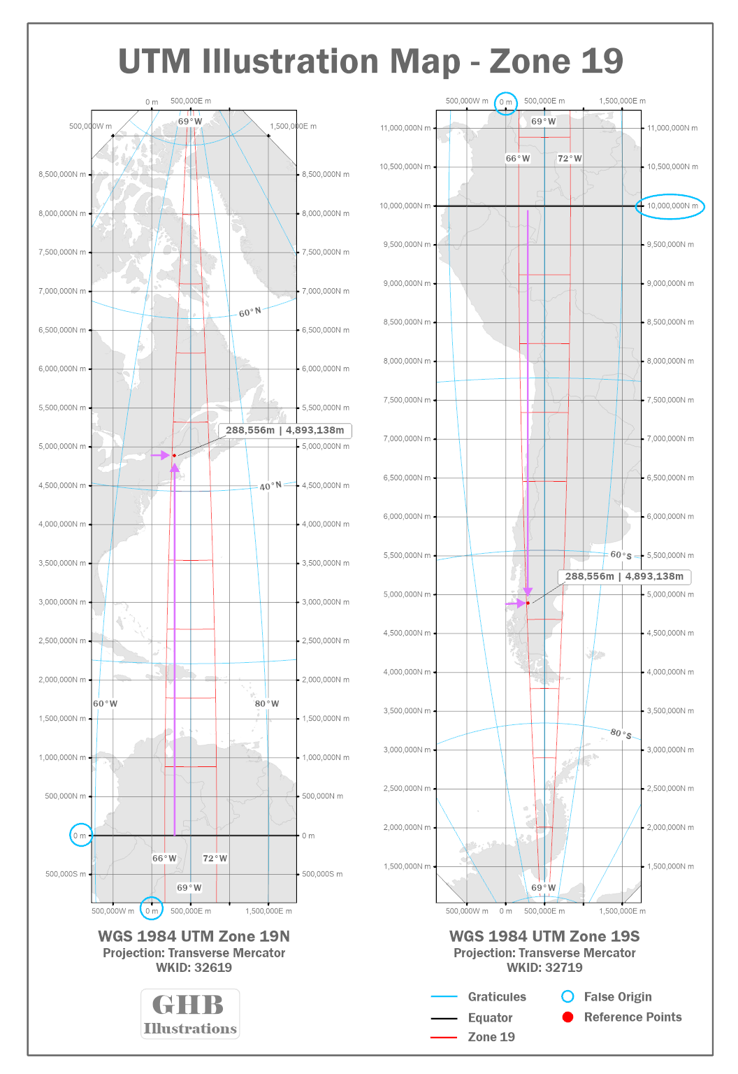
The image above illustrates how the units are referenced. For example, Mount Lafayette a summit located in the White Mountains is referenced as 288,556 meters east of the false origin and 4,893,138 meters north of the equator. Now reference the same coordinates on the trail map in the upper right. Draw a straight line from Mount Lafayette until you reach the grid. Each tic mark represents 500 meters. The first tic mark past 288000E represents 288500E meters and the remainder (56 meters) can be estimated. The northing value 4893000N is two (tic marks) up from 4892000N (1 km or 1,000 meters) the remaining 138 meters can be estimated. Below is a description of how the UTM grid values are referenced and formatted.
Eastings
Northings
- Increasing easting numbers means you are going east
- Full easting coordinate number 288000E which represents 288,000 meters east of the false origin
- The false origin is 500,000 meters west of the UTM zone’s central meridian. (-69°W)
- Distance between 288000E and 290000E is 2000 meters (2 km); each tic mark represents 500 meters
- The last 3 numbers stand for meters
- Hiking maps shown below include corner labels ex. 291,280E m
- Corner labels can be read as two hundred ninety one thousand, two hundred eighty meters east.
- Increasing northing numbers means you are going north
- Full northing coordinate is 4892000N which represents 4,892,000 meters north of the equator
- Distance between 4892000N and 4894000N is 2000 meters (2 km); each tic mark represents 500 meters
- The last 3 numbers stand for meters
- Hiking maps shown above include corner labels 4,888,935N m
- Corner labels can be read as four million, eight hundred eighty eight thousand, nine hundred thirty five meters north.
The standard meridians are 180 kilometers to the east and the west of the central meridian. Each UTM zone has its own projection and is designed to maintain the accuracy of at least one part in 2500 (i.e., distance measured over a 2500-meter course of the UTM grid system would be accurate within a meter). In the northern hemisphere, UTM coordinates are measured from a false origin located at the equator and 500,000 meters west of the UTM zone’s central meridian.
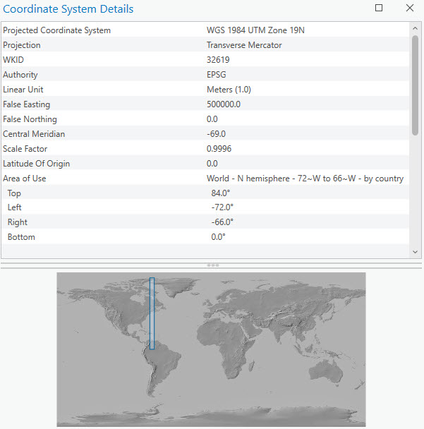
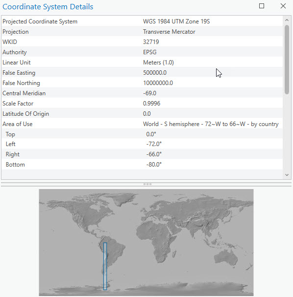
In the southern hemisphere, UTM coordinates are measured from a false origin located at 10,000,000 meters south of the equator and 500,000 meters west of the UTM zone’s central meridian. A Datum is part of the definition of a projected coordinate system, the UTM grid system may be based on NAD27, NAD83, or WGS84. So, for example if UTM Zone 19N is based on WGS84, then its full designation reads WGS 1984 UTM Zone 19N. Take a few moments and explore the UTM Zone 19 displayed in a projected and geographic coordinate system.
View Online Application
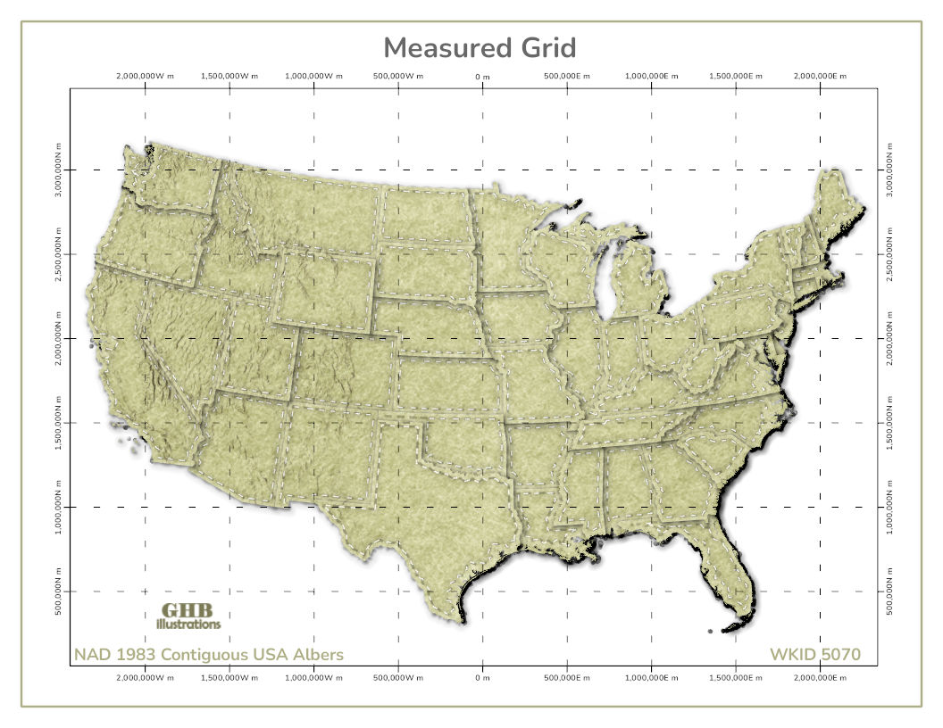
Measured Grids
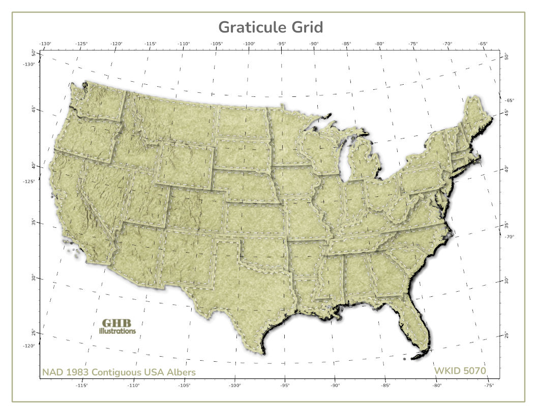
A measured grid is a pattern of lines drawn on a map that uniquely describe every point and are used to show location using projected coordinates. The grid identifies a place on a map using a combination of numbers and letters called coordinates. Different locations cannot have the same coordinate. GPS receivers displays coordinates, so once the receiver locks onto the satellites signals, the letters and numbers on the screen are your position on the map. It is important to to purchase a gps receiver that supports the grid referenced on your hard copy maps. Below are examples of two grid formats, first is the NAD 1983 Contiguous USA Albers and second is the NAD 1983 State Plane FIPS 2800 Grid for New Hampshire.
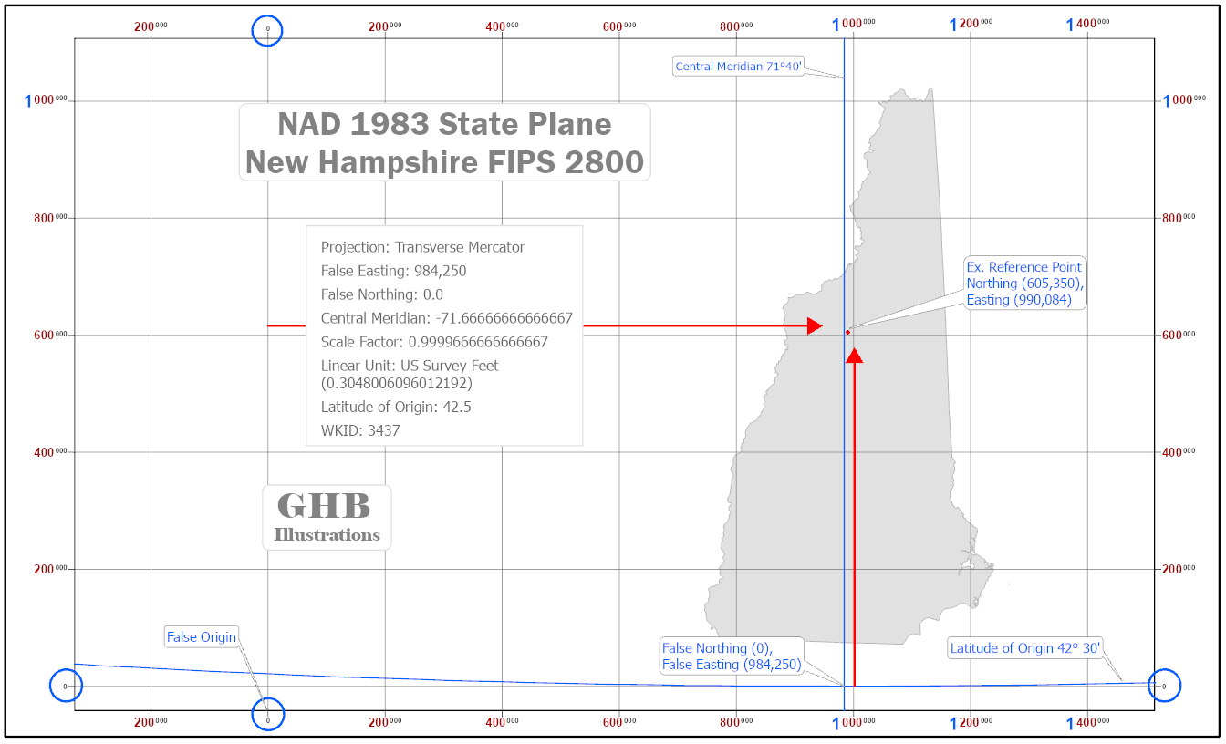
NAD 1983 State Plane New Hampshire FIPS 2800 (Feet)
The State Plane Coordinate system was created in the 1930’s to permanently record original survey monument locations in the United States. The objective was to create a conformal mapping system for the country with a maximum scale distortion of one part in 10,000 or less, which was considered the limit of survey accuracy at the time. The SPC system is 4 times more accurate that UTM grid noted above (one part in 2,500 ). So for example, a measured distance of 10,000 meters would be accurate to 1 meter. The SPC system is a coordinate grid system laid over a map projection surface for a small portion of the ellipsoid covering all or part of the state. Some consumer GPS devices and apps also implement SPSC.